

Research News


NYU Tandon Study Finds City-Level Fire Data Can Hide What's Happening Block by Block
A decade of New York City fire data shows that citywide trends can mask sharply different realities on the ground, with some neighborhoods moving in the opposite direction of the city as a whole.
A new study published in the Fire Safety Journal breaks down more than 411,000 structural fire incidents recorded by the FDNY between 2013 and 2023 across roughly 2,200 census tracts, small statistical subdivisions of a few thousand residents each, rather than the borough- or citywide figures typically used to track fire trends.
Hannah Bonestroo, a Ph.D. student in Urban Systems at NYU Tandon School of Engineering, conducted the research with Assistant Professor Augustin Guibaud, a faculty member of the Department of Mechanical and Aerospace Engineering affiliated with the NYU Tandon’s Center for Urban Science + Progress.
"If the city is looking at inequalities at the neighborhood scale, or allocating resources at the neighborhood scale, there may be areas with different patterns that get missed," said Bonestroo.
At the citywide level, the story looked simple. Structural fires fell 11.3 percent over the decade, a clear improvement. But that average hid real variation underneath it.
"If you look much more granularly at the census tract level, there were hot spots, areas where fires were actually increasing over the ten years,” said Bonestroo. Eastern Queens and Staten Island were among the places moving against the citywide trend.
Response time showed a different pattern entirely, forming large clusters of similar trends across the city rather than concentrating in pockets. Average response time rose 30 seconds over the decade, from 4 minutes 6 seconds to 4 minutes 36 seconds, now exceeding the National Fire Protection Association's 4-minute travel-time standard.
"In a fire, every second counts," said Guibaud. "Thirty seconds may not sound like much, but it can be enough time for a fire to intensify and for smoke to fill a space, and the first crew on scene can arrive to a situation that's already beyond what they can handle."
"Almost the entire city is following the pattern of it increasing," Bonestroo said, a contrast to fire frequency, which varied sharply block to block. Northwestern Queens saw the sharpest deterioration in response time over the decade.
Recent reviews by the FDNY and the New York State Senate have pointed to traffic congestion and rising call volume – the department responds to more than a million emergency calls a year – rather than neighborhood demographics or distance from firehouses. The researchers' analysis agrees, as fixed socioeconomic and built-environment factors explained only about a quarter of the differences in response time between tracts.
That contrast pointed to a second finding. Fire frequency and response time capture largely different dimensions of risk. Areas with the most fires tended to have faster response times, not slower, something Bonestroo reads as reassuring rather than puzzling.
"That's a good indicator that FDNY has placed its resources where the fires are," Bonestroo said.
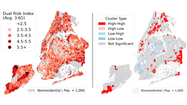
Because the two measures move independently, Bonestroo and Guibaud built a Dual Risk Index, designed to catch tracts that don't top the list on fire count or response time individually, but rank high on both at once. To put it simple, fire frequency reflects the likelihood of a fire. Response time shapes how bad it can get once one starts. The index multiplies the two.
"If you just looked at the top 50 tracts by number of fires, you might miss a tract that has a fairly high number of fires and fairly slow response time, just not the highest number and the slowest time," Bonestroo said. "That's the kind of area the index is meant to catch."
Mapped across the city, high dual-risk areas cluster in Manhattan, the Bronx, and at the city's periphery, while central Brooklyn and Queens score lowest.
Tested against the locations of multi-alarm fires, the most severe incidents, over the decade, the index performed modestly better than either individual measure at flagging high-priority tracts. None of the measures, including the index, strongly pinpointed where the city's most severe fires occurred.
"It showed that it did capture more, but it wasn't statistically significant once you account for the confidence intervals," Bonestroo said.
The researchers say that shows the need for better public data on fire outcomes. "The paper isn't meant to tell FDNY where they need to reallocate resources," Bonestroo added. "Rather, it’s meant to reveal neighborhoods that may not be following overall citywide trends and are worthy of further inquiry to understand why." The index is a starting point, as the researchers plan to test other ways of accounting for other factors such as overall building safety records.
The analysis relies entirely on public data: FDNY's Fire Incident Dispatch Data and NYFIRS, the federal NFIRS system (replaced by a new national reporting system, NERIS, in February 2026), the Mayor's Management Report, and U.S. Census Bureau estimates. “Unfortunately, these sources vary in their reporting, even though records are meant to pass between the systems unchanged, so even the most basic count depends on which record you consulted” said Guibaud.
For 2023, the city's official tally in the Mayor's Management Report lists 35,567 fires, against 30,301 for the federal NFIRS database records, some 5,300 fewer. Individual incidents were sometimes classified differently from one dataset to the next, and Bonestroo carefully mapped the discrepancy by identifying where individual fire event landed in each database.
Bonestroo received a Sheldon Tieszen Student Award in June 2026 at the International Symposium on Fire Safety Science in La Rochelle, France, for the paper.
Bonestroo, H., & Augustin, G. (2026). Structural fires and emergency response in New York City: A spatiotemporal analysis of fire incidence and severity. Fire Safety Journal, 162, 104718. https://doi.org/10.1016/j.firesaf.2026.104718

What Happens at Work When the AI Goes Away?
A new framework for thinking about artificial intelligence at work starts with a question companies have spent relatively little time asking.
What happens if the AI goes away?
Companies are racing to build generative AI into everyday work, from drafting and data analysis to scheduling and decision support. Vedant Das Swain of NYU Tandon and Koustuv Saha of the University of Illinois Urbana-Champaign argue that organizations should also prepare for the opposite possibility: a budget cut, outage, privacy rule, regulatory action or vendor dispute that suddenly makes AI unavailable.
The team describes their Counterfactual Resilience Framework, or CReF, in a Visionary Paper that they presented at the inaugural ACM AI Leadership Summit, which ran August 30 to September 2 in Atlanta. According to Das Swain, the paper is meant to inspire transformative research agendas and identify grand challenges from the engagement of the entire AI ecosystem.
CReF proposes a way for organizations and researchers to expose dependencies that may be difficult to see while AI is working normally. The framework asks users to construct a "counterfactual anchor" with three parts: a workplace setting in which AI is being used, an event that removes access to it, and the aftermath.
The idea is to treat AI's absence as a kind of stress test.
"A lot of research on human-AI teaming and complementarity assumes that LLMs and generative AI tools are like oxygen,” Das Swain said. “ It will be abundant, uniformly accessible, and continually replenished. We wanted to challenge this assumption by urging organizations to ask how they would look if AI was suddenly snatched away. Our framework helps stakeholders confront who looks productive, who retains expertise or whether basic work can continue in the face of a technological barrier, outage, or attack. Existing AI productivity frameworks excite us by focusing on the best case. Instead, we shift attention to pragmatically planning for the worst case."
The paper explores three potential vulnerabilities: whether AI benefits are distributed unevenly across jobs; whether prolonged AI use could erode skills workers need to operate independently; and whether organizations can recover when an AI-dependent workflow is disrupted.
To illustrate them, the authors construct fictional workplaces.
In one, Alex manages complicated relationships and gets relatively little benefit from AI, while Sam works on a data analytics team whose output increases after adopting it. Management begins interpreting their differing output through an AI-influenced notion of productivity. When rising costs temporarily cut off the organization's AI access, Alex's work changes little. The scenario asks whether AI can distort performance expectations when its usefulness differs dramatically among jobs.
Another scenario involves Tanya, a junior compliance analyst who has spent two years reviewing AI-drafted risk assessments rather than regularly writing them herself. When an audit prompts her employer to suspend the system, she struggles to return to manual drafting. The example is fictional, but the concern is not new. The authors connect it to decades of research on automation showing that removing people from routine practice can erode expertise they may later need during unusual or high-stakes situations.
The paper's third scenario imagines an elder-care facility that can no longer afford an AI system woven into care planning and scheduling. Workers trying to reconstruct the previous workflow discover that institutional knowledge once distributed among spreadsheets, handwritten logs and employees has become difficult to recover.
CReF does not predict that these things will happen, and it does not assign organizations a resilience score. The authors describe it instead as a "generative analysis tool" intended to expose hidden dependencies and potential safeguards.
Companies should not abandon AI, the researchers argue, but they should develop resilience alongside adoption. The question for an AI-dependent workplace, in other words, may not only be how much better people perform when the technology is available. It may also be what remains when it isn't.
Das Swain, Vedant & Saha, Koustuv. (2026). AI Resilient Future of Work: A Counterfactual Lens on Human-AI Collaboration.

A New AI Framework Could Help Cities Plan for Future Traffic
Traffic jams are usually treated as a problem to be measured after they form. Anton Rozhkov and his colleagues are exploring a different approach: giving planners state-of-the-art tools that can anticipate congestion, locate where it is most likely to emerge and translate complex traffic models into plain-language guidance.
In a new study published in the special issue of Transactions in GIS on Ethical and Explainable GeoAI, Rozhkov, Pranav Nitin Motarwar and Rudra Patil, all affiliated with NYU Tandon, developed a geospatial artificial intelligence (GeoAI) framework that combines traffic forecasting, spatial mapping and a locally hosted large language model. Rozhkov led the project and designed the framework, with Motarwar leading the forecasting work and Patil the spatial analysis. The system was tested using 15 years of New York City traffic data.
The motivation came partly from conversations Rozhkov had with urban planning practitioners. Cities increasingly want to incorporate AI into their work, he says, but planning departments may lack the technical expertise to build specialized systems. They may also be reluctant to upload sensitive transportation data to commercial models and chatbots.
“We started with an idea: what if we developed our own AI platform, one that could be hosted locally and would be secure, intuitive, and comfortable for planners to use in their day-to-day work,” Rozhkov said, describing a system that could be hosted locally and used directly by planners.
Traffic offered a useful test case because New York makes extensive transportation data publicly available. The researchers analyzed traffic observations from 2009 through 2024 and tested two methods for predicting future volumes. One was ARIMA, a conventional statistical forecasting technique. The other was a Long Short-Term Memory, or LSTM, neural network, which can identify nonlinear patterns extending across long sequences of data.
Motarwar, who trained the forecasting models, benchmarked the two approaches against each other. “ARIMA gives you seasonality, which is true but not the whole story,” he said. “The LSTM picks up the parts of the pattern that don’t repeat cleanly, and that’s where most of the improvement came from.”
On previously unseen data from 2021 through 2024, the LSTM performed better. Its average prediction error was about 343 vehicles per day, compared with roughly 418 for ARIMA, an improvement of approximately 18 percent. The model then projected average daily traffic increasing from 12,540 vehicles in 2025 to 19,680 in 2029, although those figures come with substantial prediction intervals and should be understood as forecasts rather than certainties.
But forecasting was only one piece of the project. Patil led the spatial component, mapping traffic onto Uber’s H3 system, which divides geographic space into nested hexagonal cells. Unlike citywide averages, this approach allows planners to examine congestion at multiple scales, from borough-level patterns down to localized hotspots. Clustering algorithms then identified areas where heavy traffic repeatedly accumulated. Unsurprisingly, Manhattan emerged as the highest-congestion borough in the analysis, followed by Brooklyn and Queens.
“A citywide average doesn’t help the city planners,” Patil said. “What they need to know is which corridors are badly impacted, and those turn out to be consistent year to year. That is what the hexagonal mapping and clustering were designed to explore.”
The final component turns those analytical results into something closer to a conversation. Building on the forecast and congestion maps, the researchers built a customized portal using Meta’s LLaMA model connected to a project-specific knowledge base containing forecasts, congestion locations and other traffic information. A planner could ask, for example, how a highway expansion near LaGuardia Airport might affect Queens traffic or what could happen if one-way streets in Lower Manhattan were converted to two-way streets.
Crucially, the system is designed to run locally. Agencies could keep sensitive transportation information “behind their own firewall,” Rozhkov said, rather than sending it to an outside AI service, even if sometimes the capabilities of the commercial models might be better. “A general chatbot gives you a reasonable-sounding generic paragraph about congestion,” Motarwar added. “Planners need an answer that comes from their own data. We saw this as much a data problem as a model problem.”
The researchers are not claiming that the platform can solve congestion on its own. Nor has it yet undergone a large-scale trial with working planners. Rozhkov hopes to test future versions with smaller municipalities and other planning datasets. Instead, the project demonstrates how several emerging tools can be combined into a single planning workflow. Rather than asking AI to make urban decisions, the researchers envision it as an interface between planners and increasingly complicated datasets.
That distinction also explains why the paper appeared in a special issue devoted to ethical and explainable GeoAI. For Rozhkov, the question is not simply whether cities can use increasingly powerful AI. It is how they can use it while keeping the underlying data, assumptions and decisions under local control that will eventually benefit local residents.
A Robot That Shifts Its Own Weight to Cross Land, Steps, and Water
A robot meant to inspect a coastline, a flooded street or a wetland can't count on one kind of ground. It might need to crawl over a hard surface, climb a bank, scale a curb or a step, then slide into open water, often within the same few feet.
That combination is difficult for snake- or worm-like robots. Existing amphibious designs typically handle changing terrain by switching gaits, adding specialized appendages or mechanically reconfiguring themselves. Those approaches can add complexity and potential failure points at the boundaries between terrains.
NYU Tandon Assistant Professor Nana Obayashi and Daniil Filimonov, a Ph.D. student in Obayashi’s Prema Lab, built WorMa, a name that combines "worm" and "mass," to take a different approach. It keeps the same basic undulatory gait across the terrains it crosses. The key adaptation is where its weight sits.
"The mechanism itself isn't tied to any one job,” said Obayashi, who serves on the faculty of the NYU Center for Robotics and Embodied Intelligence. “What it gives you is a robot that doesn't need to be redesigned every time the terrain changes. That could matter for environmental monitoring or infrastructure inspection, where a robot may need to cross dry ground, obstacles and water during the same mission.”
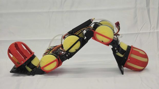
As described in a paper in Advanced Robotics Research, WorMa is a five-link, four-joint robot, 50 centimeters long and just over a kilogram, with a latex balloon water tank in its head and another in its tail. A pump in its middle shifts about 300 grams of water, 28% of the robot's total mass, between the two.
Where the water sits determines what the robot can do.
On an incline, shifting water toward the head increases the force pressing the robot's front contact points against the surface, giving them more traction. Head-biased placement was the only configuration that successfully carried WorMa up the steepest incline tested, 19.5 degrees; every other configuration slid back down. It also reduced the robot's cost of transport by at least 33% compared with the other configurations.
In water, the advantage was reversed. With its weight shifted toward the tail, WorMa swam up to 26% faster and was 52% more efficient than when its weight was concentrated at the head.
Steps required something different. Neither a fixed head-heavy nor tail-heavy robot could clear a step on its own. The researchers instead had WorMa approach the step with water in its head for traction, then shifted the water to the tail and raised the head and neck so the tail could push the robot closer. Once the head anchored on the step's edge, the water shifted back to the head and the robot continued. That sequence got WorMa over steps as high as 15 centimeters.
Getting out of the water worked only with the weight concentrated at the head. The other configurations lacked enough force at the front of the robot to pull themselves onto the slope.
Strung together, those strategies let WorMa cross a single course combining flat ground, a step, a slope and open water by shifting where the water sat at each stage. The researchers say it is the first demonstration of an undulatory robot making amphibious terrain transitions, including both entering and exiting water.
That's the practical case for building it this way. Instead of carrying specialized parts for every environment it might encounter, the robot adapts to changing terrain by redistributing mass it's already carrying. The WorMa robot is continuously getting upgraded – faster pumps and sensor-driven controls for example, could eventually allow the robot to detect changing terrain and adjust its weight on its own and more dynamically.
The work follows Obayashi's recent development of ScaFi, a fish-inspired robot designed to be built at different sizes from a single blueprint for use in environments ranging from shallow creeks to open water. Together, the projects explore a similar problem from different directions: how to build robots that can adapt to the environments they encounter without having to design a different machine for each one.
Filimonov Daniil, Obayashi Nana, WorMa: An Undulatory Robot With Center of Mass Regulation via Internal Fluid Redistribution for Amphibious Locomotion, Advanced Robotics Research 2026, 0, e70163.
A Robot That Grows Like a Fish, Not Like a Machine
Propeller-powered underwater vehicles have long helped scientists explore and monitor aquatic environments. But they're limited by their own mechanics: spinning blades can snag on vegetation, stir up sediment, and startle the wildlife they're often sent to study, making them poorly suited to shallow creeks, dense weeds, or close encounters with fish.
That's one reason roboticists have spent years building machines that swim like fish instead, bending their bodies rather than spinning a propeller. The catch is that most fish-inspired robots are built for one size and one job, so scaling them up or down usually means starting from scratch.
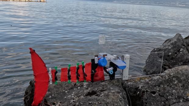
A team of engineers says it's found a way to solve that problem. They've unveiled ScaFi, a robot modeled on fish like cod and mackerel. These fish swim by concentrating most of their body bending toward the tail end, a style that, in nature, spans an unusually wide range of body sizes.
"Right now, if you want to monitor a creek and then monitor a lake, you basically need two different robots, built and tested from the ground up," said NYU Tandon’s Nana Obayashi, currently an assistant professor of mechanical and aerospace engineering and a faculty member of the NYU Center for Robotics and Embodied Intelligence, who led the project while a doctoral researcher at EPFL. "The environments we care about don't come in one size, so we don't think the tools should either."
As described in a paper in npj Robotics, ScaFi has a rigid front section and a flexible tail made of fiberglass rods. A single motor pulls two tendons that cross near the tail's end, producing the "S"-shaped bend required for fish-like swimming motion.
The diameter of the rods forming the tail are the only part that must change with the size of the robot. They grow proportionally thicker as the robot scales up, to preserve similar tail-bending behavior. The underlying motor mechanism and crossed-tendon system stay the same.
That matters because it could cut the engineering effort needed to build fish-like robots for different environments. It also gives researchers a platform for studying how swimming performance changes with scale, a question that's hard to study systematically in animals or custom-made robots alike.
The team built three robots — roughly 0.6, 1.1, and 2.9 meters long — and tested how well each swam. The smallest produced swirling water patterns similar to those left by real fish, and across all three sizes, swimming motion lined up closely once adjusted for body size, evidence the authors say that their scaling approach preserved the fish-like gait even as the robots grew nearly fivefold in length.
They also deployed the robots in the field: the medium-sized one in a Swiss stream, the largest on Lake Geneva, the smallest in creeks only 15–30 centimeters deep. During the stream test, the robot kept swimming even after a GPS dropout.
Energy efficiency proved harder to scale. The two smaller robots performed similarly, but the largest was consistently less efficient and needed a different, more powerful motor. The authors suggest drag and inertia may be to blame, though the exact cause is unresolved, meaning the team scaled the swimming motion itself more cleanly than the energy it takes to produce it.
A similar tradeoff showed up in disturbance tests. The smallest robot was most agile but recovered slowest after being knocked off course, while the larger robots were less nimble but more stable.
The researchers suggest the same approach — scaling around one key structural parameter — could apply to other compliant robots, including ones outside water. Whether energetic performance can be scaled as successfully as the swimming motion remains an open question.
The study adds to broader aquatic robotics efforts at NYU Tandon. Industry Professor Christopher Clark's research includes autonomous underwater robotic systems for exploration and environmental monitoring, while Institute Professor Maurizio Porfiri has pioneered the use of biomimetic robotic fish to study and influence animal behavior.
The co-authors on Obayashi's paper are Josie Hughes, Alexandros Anastasiadis, Karen Mulleners, Kai Junge, and Kyle L. Walker of EPFL, and Jessica Gumowski of Queensland University of Technology. The research was partially funded by the European Union's Horizon 2020 programme under Marie Skłodowska-Curie grant agreement No. 945363.
Obayashi, N., Anastasiadis, A., Gumowski, J. et al. ScaFi: length-scalable, compliant, parametric robotic fish design for operation in multiple environmental niches. npj Robot 4, 38 (2026).

Ready, Set, March: Researchers Use Math to Explain Sudden Activity Bursts in Ants
Scientists have long known that ant colonies sometimes seem to move as one. A nest that appears quiet can suddenly erupt into activity, with workers throughout the colony springing into motion almost simultaneously before settling back into stillness.
These synchronized bursts, first documented more than three decades ago, have intrigued biologists because they resemble collective phenomena seen in systems as diverse as neurons, fireflies and even chemical reactions.
Now, new research from engineers and biologists at New York University and the New Jersey Institute of Technology offers a mathematical explanation for how these rhythmic waves of activity emerge.
The study, published in Physical Review X Life, suggests that synchronized bursts arise when a colony balances two competing forces: the ability of a single active ant to rapidly excite its nestmates and the colony’s capacity to fully return to rest before the next wave begins.
Using a computational model grounded in empirical observations of ant behavior, the researchers found that colonies undergo a kind of phase transition — a sudden shift from unsynchronized movement to coordinated collective activity.
“Activity bursts emerge as a balance between the responsiveness of the colony to the first ant that activates and the ability of the colony to completely deactivate before the onset of the next burst,” said lead author Michael Napoli, a doctoral researcher in the Department of Mechanical and Aerospace Engineering at NYU.
The team combined decades of observations of ant movement with established theories of social activation. In the model, ants can occupy one of three states: active, inactive or refractory — a temporary resting period during which they cannot immediately become active again. Active ants move through a virtual nest and interact with others, sometimes triggering them to become active as well.
What emerged from the simulations was a surprisingly powerful role for individual workers. Rather than requiring many ants to coordinate simultaneously, a single ant often acted as the spark that ignited a colony-wide cascade of activity.
The researchers call this worker the “first mover.” Once activated, that ant can stimulate others, which in turn activate additional nestmates, creating a rapid chain reaction that sweeps through the colony. The process resembles a line of falling dominoes or the spread of information through a social network.
“Our results indicate that activity bursts in ant colonies are the result of a first mover that excites the colony in a synchronized regime, thereby favoring the rapid communication of new behaviors throughout the group,” the authors write.
The study also revealed that speed matters. Ants appear to operate in what the researchers describe as a “high-speed interaction regime,” where information spreads through the nest far more quickly than the duration of an activity burst itself. Under these conditions, workers constantly form and break social connections as they move, allowing information to travel efficiently across the colony.
According to senior author Maurizio Porfiri, the findings suggest that synchronized behavior depends not simply on how many interactions occur, but on how rapidly information can propagate through the network of moving individuals.
“The timescale of the motion of individuals through the nest is faster than that of the burst, suggesting that ants operate in a high-speed interaction regime where new behaviors are near-instantaneously transferred through the nest,” Porfiri said.
Although the study focuses on ants, its implications extend beyond insect societies. Simon Garnier, Professor of Biological Sciences at NJIT and coauthor on the paper, suggests similar leader-driven cascades appear in many complex systems, from grazing sheep that suddenly cluster together to neurons firing in coordinated patterns. By identifying the conditions that promote synchronization, the researchers hope to uncover general principles that govern collective behavior across biology.
The work could even inspire new approaches to engineering. Swarms of robots, for example, often rely on local interactions rather than centralized control. Understanding how a single agent can trigger coordinated action across a large population could help designers create more efficient systems for tasks such as warehouse logistics, environmental monitoring or disaster response.
The authors caution that their model simplifies many aspects of real ant colonies, including differences among workers and the complex spatial organization of nests. Future experiments will test whether real colonies operate near the synchronization threshold predicted by the model and whether manipulating density or movement patterns can alter the emergence of activity bursts.
For now, the research offers a compelling explanation for one of social insects’ most mysterious behaviors. What appears to be a colony acting with a single mind may actually begin with one ant taking the first step — and thousands of others rapidly following its lead.
This research was supported by a grant from the National Science Foundation.
Napoli, M., Garnier, S., & Porfiri, M. (2026). Nest-Level Phase Transition Drives Synchronized Activity Bursts in Ant Colonies. PRX Life, 4, 033010. doi:10.1103/ghnl-p5c1
New Model Shows Small NY Mobility Hubs Are Cutting Car Trips and Boosting Transit, Even With Sparse Data
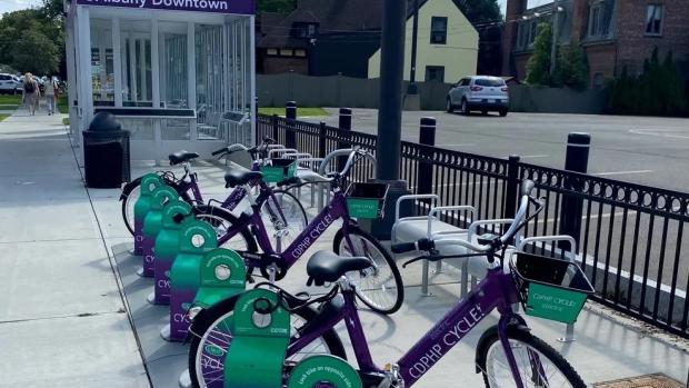
Two pilot mobility hubs in New York's Capital District are nudging commuters out of their cars and onto buses, bikes, and car-share vehicles, according to a new analysis from NYU Tandon's C2SMART transportation research center.
But the same model suggests these demonstration hubs aren't necessarily located where they’d do the most good.
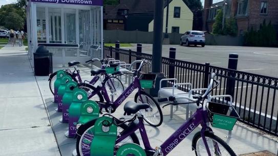
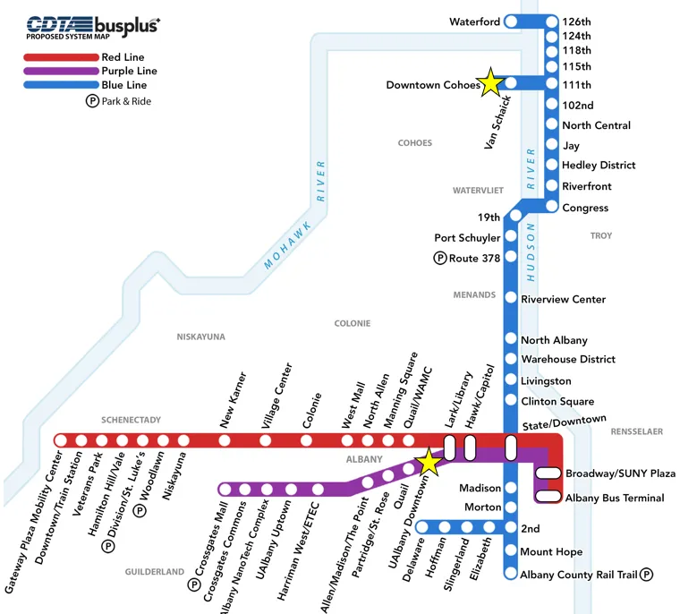
The hubs, one near UAlbany's downtown campus and the other in downtown Cohoes, work like transfer points, providing a bus stop paired with a shared bike dock that lets riders switch modes mid-trip instead of driving door to door. The Cohoes hub also offers car-share parking, a service not available at the UAlbany site.
The Tandon researchers estimate the hubs are cutting more than 75 vehicle miles driven each day and about 11 metric tons of carbon a year, roughly what two households produce annually. Riders pair two modes per trip, often combining a bus, bike-share, or walking leg with another mode, rather than driving or carpooling the whole way.
The hubs generate more than $5,000 a day in added value across both sites, a way of measuring how much better off travelers are with the extra option available, even if they never use it themselves, according to the researchers. It's not money changing hands, but a dollar figure economists use to capture things like time saved or an easier trip.
The researchers who led the study, C2SMART Deputy Director Joseph Chow, an NYU Tandon Institute Associate Professor, and Xiyuan Ren, a C2SMART postdoctoral fellow, published their findings in Transportation Research Part A.
Chow and Ren started with an existing model that predicts how New Yorkers get around, built from more than 50 million simulated trips across the state. That model can guess whether someone will drive, take transit, bike, or walk for a given trip. Mobility hubs were not reflected in the simulation because they did not exist when the underlying data was put together.
The researchers then taught the model something new: that hub trips, like driving to a bus stop then biking the rest of the way, are also an option. To make that addition realistic rather than a guess, they tuned it using real information, a 40-response survey of hub users and actual ridership numbers from the Capital District Transportation Authority (CDTA), the region's public transit agency.
They then reran that tuning process a thousand times on slightly different versions of the same small dataset, a standard statistical check to make sure their results weren't just a fluke of having so little real-world data to work with.
"You don't have enough real-world data to evaluate a pilot like this, but you also can't wait years to find out if it's working," Chow said. "Our approach borrows strength from a much larger travel model and uses the small amount of real data we have to calibrate it."
The team used the model to estimate outcomes at 1,100 locations across the region, using existing CDTA bus stops as hypothetical hub sites, not real pilots. Among all 1,100, the two actual hubs CDTA built, as part of a demonstration project that ran from April 2022 to June 2024, ranked only in the middle, roughly the 20th to 40th percentile, on measures like how many drivers they'd pull off the road and how much value riders would get.
The model suggests, in other words, that the two pilot sites weren't necessarily where a hub would have the biggest impact, likely because they were chosen for practical reasons, such as available land or existing partnerships, rather than for maximum benefit.
"It was a little surprising the two hubs CDTA built landed in the middle of the pack," Ren said. "That's not a criticism; pilots get chosen for practical reasons. But it suggests real value in running this kind of analysis before committing to a location."
The authors say the same approach, pairing a small on-site sample with a large behavioral model, could extend to other emerging services, such as autonomous shuttles or microtransit, before enough ridership data accumulates to build a model from scratch. Chow said the underlying statewide model isn't specific to mobility hubs, the team has previously used it to evaluate other mobility service programs, and since it draws on data available nationwide, the same approach could extend beyond New York.
Support for the research was provided by the New York State Energy Research and Development Authority (NYSERDA).
Xiyuan Ren, Joseph Y.J. Chow, A data fusion approach for mobility hub impact assessment and location selection: Integrating hub usage data into a large-scale mode choice model, Transportation Research Part A: Policy and Practice, Volume 211, 2026
New Study Highlights the Weather-Driven Costs of 24/7 Clean Power Matching
As demand for electricity surges from artificial intelligence, data centers, and other new technologies, companies are increasingly pledging to procure carbon-free electricity to mitigate emissions associated with their electricity use. While quantifying system-wide emissions is relatively straightforward, the complex nature of power grid operations makes it more challenging to ascertain the emissions impacts of a single consumer that also procures its own clean energy. This challenge is further compounded by clean energy sources like solar and wind, whose hour to hour generation can vary drastically, depending on weather patterns.
A new study by researchers at NYU Tandon and the Massachusetts Institute of Technology evaluated the system impacts of so-called 24/7 or hourly matching, involving matching grid electricity consumption with generation from procured clean electricity, a strategy of growing corporate and regulatory interest. By incorporating multiple years of weather variability into sophisticated power-system models, the researchers found that procuring clean electricity to match consumption every hour of the day can deliver emissions benefits, but at higher cost than previous studies suggested. The work also indicates that in regions already pursuing aggressive renewable energy policies, less strict approaches may achieve nearly the same climate benefits for considerably less money.
The study, published in Environmental Science & Technology, focuses on electricity-based production of hydrogen, a pathway of growing interest to decarbonize difficult-to-electrify segments of the economy like heavy industry. Recently, governments in both the United States and Europe have proposed or implemented rules requiring producers to match their electricity use with generation from newly built renewable energy resources, initially on an annual basis and eventually on an hourly basis. Beyond hydrogen, the findings apply broadly to other large electricity consumers, including data centers, and speak directly to ongoing revisions of the Greenhouse Gas Protocol's Scope 2 rules, the standard many companies use to account for and report the emissions tied to their electricity use, where hourly matching is a central proposal under debate.
Until now, however, most analyses on hourly matching have relied on a single year of weather data to characterize wind and solar resource variability. In reality, wind and solar resources fluctuate significantly from year to year.
"We wanted to understand how real-world, inter-annual weather variability changes the economics and emissions of clean electricity procurement," said senior author Dharik S. Mallapragada, associate professor of chemical and biomolecular engineering at NYU Tandon. "When projects are expected to operate for decades, designing them around a single weather year can paint an overly optimistic picture of both cost and performance."
To explore that question, the researchers modeled a grid-connected hydrogen facility operating in the Texas power grid, one of the nation's largest renewable energy markets. They optimized investments across nine representative years of historical wind and solar conditions, both individually and collectively, and then tested those designs for their robustness against additional weather scenarios.
The team's model consistently showed that hourly matching costs more than annual matching and that the cost premium is sensitive to the weather year, varying between ranging from $0.68 to $1.18/kg of H2 produced. For context, the average cost of fossil H2 production is around $1/kg. The team also showed that such single weather-year based investment plans can lead to shortfalls in clean electricity supply across multiple hours of the year when tested against additional weather scenarios not included in the planning analysis.
The cost of clean electricity procurement to be robust to inter-annual weather variations was found to lead to a still higher cost premium, of $1.29 per kilogram compared with annual matching. This cost premium stems from oversizing the capacity of wind and solar farms to manage shortfalls in supply as well as installing larger electrolyzers capable of ramping production up and down, along with extensive hydrogen storage to buffer periods when renewable generation falls short.
The researchers also examined ways to reduce costs of 24/7 matching without sacrificing most of the environmental benefits. Allowing hydrogen producers to match80 to 90 percent of their hourly electricity needs with clean power lowered costs while retaining much of the emissions benefits achieved under full compliance. Likewise, if hydrogen production operates within electricity grids already governed by strong renewable portfolio standards, annual matching performed nearly as well as hourly matching from an emissions standpoint, but at much lower costs. A further option, with similar emissions outcomes at a comparable or lower cost, is to fold new electricity demand directly into those existing renewable portfolio standards rather than layering separate, granular, matching requirements on top. These findings speak directly to ongoing debates among governments and corporations over the role of "24/7 matching" in voluntary and regulatory emissions reporting.
Michael A. Giovanniello, Dharik S. Mallapragada; Emissions and Cost Trade-Offs of Time-Matched Clean Electricity Procurement under Interannual Weather Variability: A Case Study of Hydrogen Production. Environ. Sci. Technol. 21 July 2026; 60 (28): 19854–19865. https://doi.org/10.1021/acs.est.6c00988
Inside the Urban Machine: Where America's Data Centers Actually Live
Updated August 3, 2026 to include Note on Methodology and Terminology.
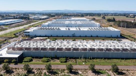
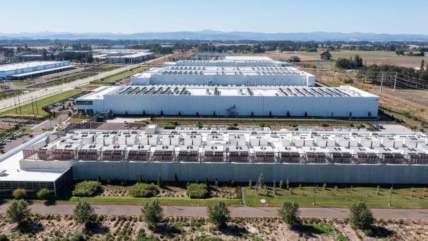
When people picture a data center, they often imagine something remote: a huge warehouse humming quietly far from the city. New research from NYU Tandon School of Engineering shows that assumption is largely wrong.
The study, published in Nature Cities, examined the locations of 4,283 data centers across the contiguous United States and found that 97.5% of them sit inside metropolitan or micropolitan statistical areas, meaning urban cores and their immediate surroundings.
The roughly 2.5% of facilities technically outside city limits are, on average, just 8.5 miles from the nearest urban edge. The cloud lives downtown.
"There is a prevailing narrative of these data centers being somewhere in the middle of nowhere, in rural areas, being a positive force for employment, and being the future of rural communities," said lead researcher, NYU Tandon Institute Professor Maurizio Porfiri, who is the Director of Tandon’s Center for Urban Science + Progress and of the NYU Urban Institute. "We dramatically challenged this view."
The concentration is striking even within the urban category. Five metro areas, Washington-Arlington-Alexandria, Chicago, Dallas-Fort Worth, New York-Newark-Jersey City, and Phoenix, account for nearly a third of all U.S. facilities. The Washington region alone hosts 610 data centers, reflecting Northern Virginia's status as the global capital of data infrastructure (see appendix).
So why cities?
The answer, the researchers found, suggests that a lot has to do with what’s already there and what used to be there.
The single strongest predictor is electricity capacity, meaning how much power local generators can produce. Data centers are power-hungry, running thousands of servers around the clock and drawing enormous, steady loads from the grid.
But a notable finding goes beyond electricity supply. Closed coal plants near cities are becoming magnets for new data center builds. When a plant shuts down, the power lines and grid connections built to carry electricity continuously do not disappear. Data center developers can tap directly into that infrastructure, or, in some cases, redevelop the sites themselves.
The numbers bear this out. Among cities that overlap with areas designated as Energy Communities under a 2022 federal policy, data centers under development are twice as likely to be found there than in cities without that designation (see appendix).
The policy was designed to direct clean-energy investment toward regions hurt by coal plant closures. The research suggests the digital economy may be taking root in many of the same places as the fossil fuel economy it is meant to succeed.
Because data centers draw from their local grid, their carbon footprint depends heavily on how that grid generates power. A typical data center in Montana or North Dakota produces more than 350,000 tons of CO2 emissions annually, while the average facility in Vermont, New Hampshire, or Arkansas produces less than 3,000 tons.
Beyond electricity supply, data centers also cluster where IT workers and high-speed internet are concentrated. Local water shortages seem to have less of an impact on data center placement, despite the facilities consuming enormous amounts of water for cooling.
The opacity of the industry compounds all of these problems.
“As this industry rapidly grows, the limited publicly available data on its footprint creates a real challenge,' said Ofek Lauber Bonomo, a postdoctoral researcher in Porfiri’s Dynamical Systems lab and a paper co-author. “That makes it more difficult for planners, for local residents, and for anyone trying to make informed decisions about their community's future."
"The patterns we found were consistent and clear,” added Anton Rozhkov, a CUSP Industry Assistant Professor and paper co-author. “Where the infrastructure already exists, the data centers follow. The question now is whether that is the future we want to build.”
The Nature Cities paper follows the recent announcement that Porfiri and Camilla Ancona – a paper co-author and postdoctoral researcher in Porfiri’s Dynamical Systems Lab – were named among the 2026 cohort of Microsoft Research Fellows, to advance their work using AI-driven simulations to help utilities and regulators decide where to site data centers before breaking ground.
The research in the Nature Cities paper was supported by the NYU Abu Dhabi (NYUAD) Center for Interacting Urban Networks, funded by the Abu Dhabi government through the NYUAD Research Institute.
Ancona, C., Lauber Bonomo, O., Rozhkov, A. et al. Urban infrastructure and fossil fuel industrial legacy drive US data center siting. Nat Cities (2026). https://doi.org/10.1038/s44284-026-00487-z
Note on Methodology and Terminology:
This study analyzed a 2025 dataset of 4,283 commercial data centers in the contiguous United States from the commercial Data Center Map database. The dataset includes operational facilities as well as projects that were planned, under construction, or land-banked at the time of analysis. Throughout this article, "city" refers to metropolitan and micropolitan statistical areas (MSAs and MicroSAs), as defined by the U.S. Office of Management and Budget, which classify counties based on economic integration with an urban core rather than population density or land use. As a result, some counties classified as part of metropolitan or micropolitan areas may have low population density or predominantly rural land use. The study characterizes the overall geographic distribution of U.S. data centers by facility count during the study period.
Appendix
Data centers in each metro area - top 10
|
# |
Metro area |
Facilities |
Share of U.S. total |
|---|---|---|---|
|
1 |
Washington–Arlington–Alexandria |
610 |
14.2% |
|
2 |
Chicago–Naperville–Elgin |
241 |
5.6% |
|
3 |
Dallas–Fort Worth–Arlington |
192 |
4.5% |
|
4 |
New York–Newark–Jersey City |
163 |
3.8% |
|
5 |
Phoenix–Mesa–Chandler |
154 |
3.6% |
|
6 |
Atlanta–Sandy Springs–Roswell |
136 |
3.2% |
|
7 |
Columbus |
133 |
3.1% |
|
8 |
San Jose–Sunnyvale–Santa Clara |
130 |
3.0% |
|
9 |
Los Angeles–Long Beach–Anaheim |
90 |
2.1% |
|
10 |
Des Moines-West Des Moines |
76 |
1.8% |
Data centers in Energy Community (EC) designated areas - top 8
|
# |
Metro area |
Under-development data centers |
|---|---|---|
|
1 |
Chicago–Naperville–Elgin, IL–IN |
108 |
|
2 |
Dallas–Fort Worth–Arlington, TX |
58 |
|
3 |
Washington–Arlington–Alexandria, DC–VA–MD–WV |
26 |
|
4 |
San Antonio–New Braunfels, TX |
24 |
|
5 |
Reno, NV |
18 |
|
6 |
New Haven, CT |
12 |
|
7 |
Scranton–Wilkes-Barre, PA |
11 |
|
8 |
Monroe, LA |
10 |
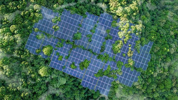
Solar Panels Promise To Help Save the Environment. But What Happens When They Die?
Solar panels have become the most iconic symbol of the clean energy transition. They cover rooftops, stretch across deserts, and quietly convert sunlight into electricity without emitting carbon dioxide. But hidden behind this success story is a growing environmental challenge that few people think about: what happens when millions of those panels reach the end of their lives?
By 2050, discarded photovoltaic modules could generate more than 80 million metric tons of waste. Unless new recycling methods are developed, many of those panels could end up in landfills, taking with them valuable metals that required enormous amounts of energy and mining to produce in the first place.
"Solar panels are the clean energy infrastructure of the future," says Juanita Hidalgo, Assistant Professor of Chemical and Biomolecular Engineering at NYU Tandon. "But to make solar truly sustainable, we also need to think about what happens after these technologies reach the end of their lifetime."
A new perspective paper, coauthored by Hidalgo and post-doctoral researcher Sara Hamilton, argues that one of the most promising solutions lies not in hotter furnaces or more intensive manufacturing, but in chemistry. Researchers are increasingly turning to hydrometallurgy, a family of recycling techniques that uses liquids to selectively dissolve and recover valuable metals. Instead of heating an entire solar panel at temperatures approaching 2,000 degrees Celsius, hydrometallurgy carefully separates individual components at low temperatures so they can be reused in new devices.
"It's a much more selective approach," explains Hamilton. "Rather than treating a solar panel as waste, we're treating it as a source of valuable materials that can be recovered and put back into the supply chain."
Today's recycling systems recover relatively simple materials such as aluminum frames, glass, and copper wiring. But the heart of every solar panel contains metals that are both economically valuable and strategically important. Silver, indium, gallium, tellurium, and lead all play critical roles in different kinds of solar cells, yet recovering them remains technically difficult and often too expensive to justify. Current recycling methods frequently rely on pyrometallurgy, which uses extremely high temperatures to melt materials apart. While effective, the process consumes large amounts of energy and can make it difficult to separate individual metals cleanly.
Hydrometallurgy offers a more tunable alternative. Carefully selected solvents dissolve specific metals, which can then be purified and recovered for reuse. In principle, the approach requires less energy and can recover materials with much greater precision.
But the researchers found that not all solar technologies are equally easy to recycle. Conventional crystalline silicon panels, which account for roughly 95 percent of the global solar market, typically require strong acids such as nitric acid to extract valuable silver. Those acids work well, but they are corrosive, hazardous to handle, and difficult to recycle themselves. Thin-film solar cells face similar challenges. Although they contain smaller amounts of material overall, they rely on critical metals such as indium, gallium, and tellurium that are usually recovered using equally aggressive chemical treatments.
One surprise was the recyclability of the hottest new solar technology. Perovskite solar cells have generated enormous excitement because they can be manufactured at lower cost than conventional silicon while achieving record-setting efficiencies in the laboratory. The new perspective suggests they are also remarkably well suited for environmentally friendly recycling.
Unlike conventional solar cells, perovskites are built from layers connected by relatively weak chemical interactions. As a result, several recent studies have shown that researchers can recover one of their most important ingredients — lead — using something unexpectedly simple: hot water. As the water cools, the dissolved lead crystallizes back into a compound that can be used to manufacture new perovskite solar cells.
The authors argue that recyclability should become a design goal rather than an afterthought. Instead of maximizing efficiency first and worrying about disposal decades later, engineers could build future solar cells with disassembly and material recovery in mind from the very beginning.