
Joseph Chow
,
Ph.D., PE
-
Full Professor
-
Deputy Director of C2SMART Center
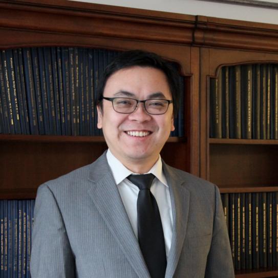
Dr. Joseph Chow is a Professor in the Department of Civil, Urban, and Environmental Engineering and the Deputy Director at the C2SMART Center at NYU, and heads BUILT@NYU: the Behavioral Urban Informatics, Logistics, and Transport Laboratory. His research expertise lies in transportation systems, with emphasis on multimodal networks, behavioral urban logistics, smart cities, and transport economics. He is an NSF CAREER award recipient; he is a former elected Chair of the Urban Transportation SIG and appointed TSL Cluster Chair at INFORMS Transportation Science & Logistics Society, former chair of the TRB subcommittee on Route Choice and Spatiotemporal Behavior, and is an Associate Editor for Transportation Research Part C, INFORMS Service Science, Transportation Research Record, and Transportation Research Part B. At NYU he is an Associated Faculty at CUSP, Rudin Center, Sustainable Engineering Initiative, and an Affiliated Faculty member of NYU-KAIST. As of 2025, Dr. Chow was in career-wide Top 2% of scientists worldwide in the area of Transportation & Logistics. His research was featured among the 50 greatest innovations in 2024 by Popular Science. Prior to NYU, Dr. Chow was the Canada Research Chair in Transportation Systems Engineering at Ryerson University. From 2010 to 2012, he was a Lecturer at University of Southern California and a Postdoctoral Scholar at UC Irvine. He obtained a Ph.D. in Transportation Engineering from UC Irvine (‘10), and an M.Eng. (‘01) and B.S. (‘00) in Civil Engineering from Cornell University with a minor in Applied Math. Dr. Chow is a former Eisenhower and Eno Fellow and a licensed PE in NY.
Education
Cornell University
Bachelor of Science, Civil Engineering, 2000
Cornell University
Master of Engineering, Civil Engineering, 2001
University of California, Irvine
Doctor of Philosophy, Civil Engineering, 2010
Experience
University of Southern California
Lecturer/Instructor
Epstein Department of Industrial and Systems Engineering Sol Price School of Public Policy
From: May 2010 to May 2012
University of California, Irvine
Postdoctoral Scholar
Institute of Transportation Studies
From: April 2010 to May 2012
Ryerson University
Canada Research Chair and Assistant Professor
Department of Civil Engineering
From: June 2012 to August 2015
New York University
Assistant Professor
Department of Civil & Urban Engineering
From: September 2015 to August 2021
Institute Associate Professor
From: September 2021 to August 2026
Professor
From: September 2026 to Present
Publications
Journal Articles
ORCID: 0000-0002-6471-3419
Select articles:
1) Sayarshad, H.R., Chow, J.Y.J., 2017. Non-myopic relocation of idle mobility-on-demand vehicles as a dynamic location-allocation-queueing problem. Transportation Research Part E 106, 60-77.
2) Ma, Z., Urbanek, M., Pardo, M.A., Chow, J.Y.J., Lai, X., 2017. Spatial welfare effects of shared taxi operating policies for first mile airport access, International Journal of Transportation Science and Technology, in press, doi: 10.1016/j.ijtst.2017.07.001.
3) Djavadian, S., Chow, J.Y.J., 2017. An agent-based day-to-day adjustment process for modeling ‘Mobility as a Service’ for a two-sided flexible transport market, Transportation Research Part B, 104, 36-57.
4) Guo, Q.W., Chow, J.Y.J., Schonfeld, P., 2017. Stochastic dynamic switching in fixed and flexible transit services as market entry-exit real options. Transportation Research Part C, Special issue on ISTTT 22, accepted for publication.
5) Mendes, L.M., Bennàssar, M.R., Chow, J.Y.J., 2017. Simulation experiment to compare light rail streetcar against shared autonomous vehicle fleet for Brooklyn Queens Connector. Transportation Research Record, in press, doi: 10.3141/2650-17.
Other Publications
Book Chapters:
1) Chow, J.Y.J., Jayakrishnan, R., Mahmassani, H.S., 2013. Is transport modeling education too multidisciplinary? A manifesto on the search for its evolving identity. Travel Behaviour Research: Current Foundations, Future Prospect, eds. E.J. Miller and M.J. Roorda, Lulu Publishing.
Grants
CAREER: Urban Transport Network Design with Privacy-Aware Agent Learning, (Principal Investigator)
National Science Foundation, 2017 - 2022
Stable Matching of Service Tours to Design Cooperative Policies for Transport Infrastructure Systems, (Principal Investigator)
NSF, 2016 - 2019
Design of Smarter Urban Logistics Systems, (Principal Investigator)
Canada Research Chairs Program, 2013 - 2016
Multimodal Systems Design with Network Interactions, (Principal Investigator)
NSERC, 2013 - 2016
Development of mobile device-based surrogate systems for connected and autonomous vehicle technologies, (Principal Investigator)
NSERC, OCE, 2015
Agent-based decision support system for a flexible transit service pilot, (Principal Investigator)
NSERC, 2015
Affiliations
- Associated Faculty, NYU Center for Urban Science & Progress
- Associated Faculty, Rudin Center for Transportation Policy and Management
- Associated Faculty, Sustainable Engineering Initiative
- NYU-KAIST Affiliated Faculty
- Former Chair, INFORMS TSL Society, Urban Transportation SIG
- Associate Editor, Transportation Research Part B from Elsevier
- Associate Editor, Transportation Research Part C from Elsevier
- Associate Editor, Service Science from INFORMS
- Associate Editor, Transportation Research Record, from Sage Journals
Information for Mentees
About Me: Local NYer, studied in California, taught briefly in Toronto, up for coffee/tea chats
Research News
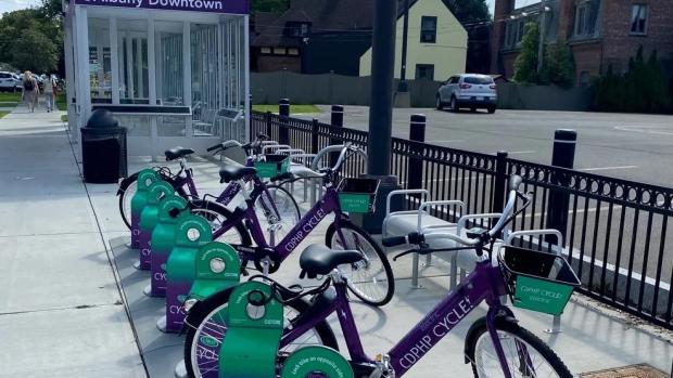
New Model Shows Small NY Mobility Hubs Are Cutting Car Trips and Boosting Transit, Even With Sparse Data
Two pilot mobility hubs in New York's Capital District are nudging commuters out of their cars and onto buses, bikes, and car-share vehicles, according to a new analysis from NYU Tandon's C2SMART transportation research center.
But the same model suggests these demonstration hubs aren't necessarily located where they’d do the most good.
The hubs, one near UAlbany's downtown campus and the other in downtown Cohoes, work like transfer points, providing a bus stop paired with a shared bike dock that lets riders switch modes mid-trip instead of driving door to door. The Cohoes hub also offers car-share parking, a service not available at the UAlbany site.
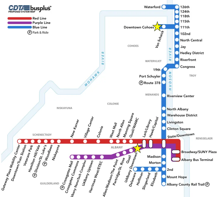
The Tandon researchers estimate the hubs are cutting more than 75 vehicle miles driven each day and about 11 metric tons of carbon a year, roughly what two households produce annually. Riders pair two modes per trip, often combining a bus, bike-share, or walking leg with another mode, rather than driving or carpooling the whole way.
The hubs generate more than $5,000 a day in added value across both sites, a way of measuring how much better off travelers are with the extra option available, even if they never use it themselves, according to the researchers. It's not money changing hands, but a dollar figure economists use to capture things like time saved or an easier trip.
The researchers who led the study, C2SMART Deputy Director Joseph Chow, an NYU Tandon Institute Associate Professor, and Xiyuan Ren, a C2SMART postdoctoral fellow, published their findings in Transportation Research Part A.
Chow and Ren started with an existing model that predicts how New Yorkers get around, built from more than 50 million simulated trips across the state. That model can guess whether someone will drive, take transit, bike, or walk for a given trip. Mobility hubs were not reflected in the simulation because they did not exist when the underlying data was put together.
The researchers then taught the model something new: that hub trips, like driving to a bus stop then biking the rest of the way, are also an option. To make that addition realistic rather than a guess, they tuned it using real information, a 40-response survey of hub users and actual ridership numbers from the Capital District Transportation Authority (CDTA), the region's public transit agency.
They then reran that tuning process a thousand times on slightly different versions of the same small dataset, a standard statistical check to make sure their results weren't just a fluke of having so little real-world data to work with.
"You don't have enough real-world data to evaluate a pilot like this, but you also can't wait years to find out if it's working," Chow said. "Our approach borrows strength from a much larger travel model and uses the small amount of real data we have to calibrate it."
The team used the model to estimate outcomes at 1,100 locations across the region, using existing CDTA bus stops as hypothetical hub sites, not real pilots. Among all 1,100, the two actual hubs CDTA built, as part of a demonstration project that ran from April 2022 to June 2024, ranked only in the middle, roughly the 20th to 40th percentile, on measures like how many drivers they'd pull off the road and how much value riders would get.
The model suggests, in other words, that the two pilot sites weren't necessarily where a hub would have the biggest impact, likely because they were chosen for practical reasons, such as available land or existing partnerships, rather than for maximum benefit.
"It was a little surprising the two hubs CDTA built landed in the middle of the pack," Ren said. "That's not a criticism; pilots get chosen for practical reasons. But it suggests real value in running this kind of analysis before committing to a location."
The authors say the same approach, pairing a small on-site sample with a large behavioral model, could extend to other emerging services, such as autonomous shuttles or microtransit, before enough ridership data accumulates to build a model from scratch. Chow said the underlying statewide model isn't specific to mobility hubs, the team has previously used it to evaluate other mobility service programs, and since it draws on data available nationwide, the same approach could extend beyond New York.
Support for the research was provided by the New York State Energy Research and Development Authority (NYSERDA).
Xiyuan Ren, Joseph Y.J. Chow, A data fusion approach for mobility hub impact assessment and location selection: Integrating hub usage data into a large-scale mode choice model, Transportation Research Part A: Policy and Practice, Volume 211, 2026
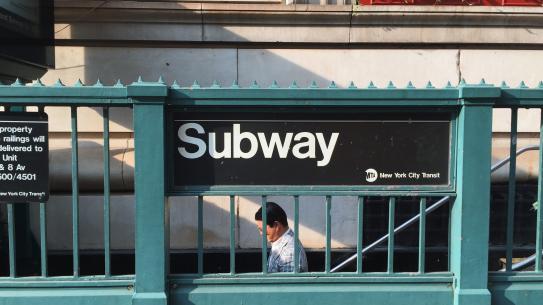
When the Rain Comes, Some New York City Subway Riders Stay Home. Scientists Are Now Mapping Exactly Who, and Where
On a sweltering August afternoon or in the teeth of a winter storm, New York City subway riders make a quiet calculation: Is the trip worth it?
A new study published in npj Sustainable Mobility and Transport takes a detailed look at how those decisions show up in ridership patterns across the system, and how they vary from station to station.
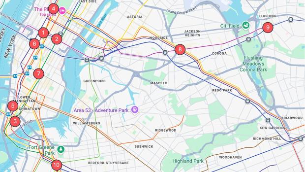
Researchers from NYU Tandon, the University of Louisville, and the University of Hong Kong analyzed hourly ridership at 10 major subway stations between 2023 and 2025. Using a statistical technique called vine copula modeling, they examined how stations’ ridership moves together under different weather conditions rather than treating each station as an isolated case.
“Think about what actually happens when a storm hits,” said Joseph Chow, one of the paper’s authors and an NYU Tandon Institute Associate Professor. “There is structure in how the riders of a system respond to the storm, almost like a unique “signature” of the system to a type of extreme weather event. Understanding these structures and how they evolve can help different cities better prepare their public transit systems to be resilient against extreme weather events.”
Heavy precipitation has the strongest effect during the evening rush hour. As detailed in the appendix, median declines during heavy rain range from nearly 29 percent at Columbus Circle to less than 8 percent at Grand Central. Outer-borough stations such as Flushing–Main Street also show large declines, approaching 26 percent.
Evening travel is more flexible than morning commutes, so heavy rain tends to shift or suppress trips rather than eliminate them entirely. Riders may leave earlier, wait out the storm, or cancel discretionary plans, leading to sharper drops during that specific peak hour even though most still get home, the researchers explained.
Extreme cold tells a different story. Even during the morning rush, when its effects are strongest, ridership declines are modest, generally between about 1 and 2.4 percent across stations. Larger effects appear off-peak, when discretionary trips are more likely to be canceled.
“Commuters maintain their routines even when temperatures plunge,” Chow said, who is also the Deputy Director of C2SMART, Tandon’s transportation research center. “It’s the discretionary traveler, the person heading to a restaurant or a friend’s apartment, who cancels the transit trip or switches to a different mode.”
The study also highlights sharp differences between nearby stations. Columbus Circle emerges as one of the most weather-sensitive locations during heavy rain, while Grand Central, less than two miles away, shows comparatively small declines.
That variation suggests borough location alone does not determine resilience. Infrastructure, station design, connectivity, and surrounding land use all appear to play a role.
“What we’re giving planners is a way to see the whole network respond to a storm or a heat wave, not just one station at a time. And this method allows them to generate other plausible ridership scenarios under extreme weather, aiding decision-making,” said Omar Wani, a NYU Tandon Assistant Professor and a paper author.
The authors emphasize important limitations. The analysis focuses on 10 high-ridership stations, and extreme weather events are relatively rare in the data. To address this, the model generates plausible ridership patterns based on observed relationships across stations.
That means the results should be interpreted as estimates of likely responses, rather than simple averages of past storms.
Even so, a clear pattern emerges. Heavy rain hits hardest during peak hours, while extreme cold has a greater effect off-peak, and the differences between stations are consistent rather than random.
The implications extend beyond operations. Because some neighborhoods rely more heavily on transit, uneven drops in ridership during extreme weather may translate into uneven burdens. As climate change increases the frequency of severe weather, understanding where and when riders stay home could help agencies plan more targeted responses.
In addition to Chow and Wani, the paper’s authors are Yan Guo and Brian Yueshuai He of the University of Louisville; and Zhiya Su of the University of Hong Kong. Funding for the research was provided by the National Science Foundation.
Guo, Y., He, B.Y., Chow, J.Y.J. et al. Assessing subway ridership resilience under extreme weather with vine copula modeling. npj. Sustain. Mobil. Transp. 3, 25 (2026). https://doi.org/10.1038/s44333-026-00094-4
Appendix
The tables below show median declines in ridership at the ten stations studied, compared with normal weather conditions. Each weather type is measured during the peak period when its effects are most pronounced, using the evening commute (4 to 5 p.m.) for heavy rain and the morning commute (8 to 9 a.m.) for extreme cold.
|
Station |
Borough |
Median Decline, |
|
Columbus Circle |
Manhattan |
-28.9% |
|
Flushing-Main St |
Queens |
-26.4% |
|
Fulton Street |
Manhattan |
-24.7% |
|
Times Square |
Manhattan |
-23.9% |
|
Chambers St/WTC |
Manhattan |
-21.5% |
|
Atlantic Av-Barclays Center |
Brooklyn |
-21.4% |
|
Broadway/Jackson Heights |
Queens |
-20.4% |
|
Penn Station |
Manhattan |
-19.3% |
|
Union Square |
Manhattan |
-10.2% |
|
Grand Central |
Manhattan |
-7.8% |
|
Columbus Circle |
Manhattan |
-2.4% |
|
Flushing-Main St |
Queens |
-2.4% |
|
Fulton Street |
Manhattan |
-2.0% |
|
Broadway/Jackson Heights |
Queens |
-2.0% |
|
Chambers St/WTC |
Manhattan |
-1.9% |
|
Penn Station |
Manhattan |
-1.8% |
|
Atlantic Av-Barclays Center |
Brooklyn |
-1.8% |
|
Times Square |
Manhattan |
-1.7% |
|
Grand Central |
Manhattan |
-1.1% |
|
Union Square |
Manhattan |
-1.00% |
|
Station |
Borough |
Median Decline, |
|
Flushing-Main St |
Queens |
-2.4% |
|
Fulton Street |
Manhattan |
-2.0% |
|
Broadway/Jackson Heights |
Queens |
-2.0% |
|
Chambers St/WTC |
Manhattan |
-1.9% |
|
Penn Station |
Manhattan |
-1.8% |
|
Atlantic Av-Barclays Center |
Brooklyn |
-1.8% |
|
Times Square |
Manhattan |
-1.7% |
|
Grand Central |
Manhattan |
-1.1% |
|
Union Square |
Manhattan |
-1.0% |
Synthetic data holds the key to determining best statewide transit investments
Synthetically generated population data can reveal the equity impacts of distributing transportation resources and funding across diverse regions, according to new research from NYU's Tandon School of Engineering that uses New York State as a case study.
Relying on an artificial dataset representing 19.5 million New York residents and over 120,000 modeled origin-destination trips, researchers from NYU Tandon's C2SMARTER, a Tier 1 U.S U.S. Department of Transportation-funded University Transportation Center, determined how best to invest in transportation services when equitable benefits are an objective.
They presented the findings in a paper published in Transportation Research Part D: Transport and Environment.
"Policymakers often use surveys to allocate transportation resources, but these surveys frequently underrepresent low-income and marginalized communities," said Joseph Chow, Institute Associate Professor of Civil and Urban Engineering, who led the study. "We developed a completely new approach for transportation planning, showing that synthetic data can consistently assess equity impacts across large regions like New York State. Our statewide model parameters are available to any agency to study the multiple effects of new service designs, something previously impossible."
The research team developed what they call an "equity-aware choice-based decision support tool.”
Given a budget level, the proposed tool selects optimal service regions for one or two new mobility services considering four objectives: (1) maximizing total revenue, (2) maximizing total increased consumer surplus, meaning delivering consumers cost savings (3) minimizing consumer surplus disparity, meaning making the benefits fair between different groups and (4) minimizing consumer surplus insufficiency, meaning ensuring baseline benefits even in areas that are less profitable.
The first two objectives focus on making the transportation system more efficient and profitable overall. The last two objectives emphasize making sure the benefits are distributed more equitably among different consumer groups and regions.
Using the tool with New York State synthetic data, researchers focused on two hypothetical mobility services: ride-hailing services that offer shorter travel times but higher trip fares, and on-demand microtransit services that provide longer travel times with lower trip fares. The results showed that:
- Investing mostly in ride-hailing services, focusing on longer trips in metropolitan areas like New York City, maximized revenue.
- Also prioritizing ride-hailing services but covering shorter trips in metropolitan areas maximized consumer surplus.
- Investing mainly in on-demand microtransit service, targeting disadvantaged communities, minimized consumer surplus disparity,
- Splitting the budget between ride-hailing and microtransit services, covering both urban and rural areas, balanced equity and efficiency,
"Microtransit played an outsized role boosting equity, proving more viable in disadvantaged areas. But it needed subsidies to offset lower productivity than ride-hailing,” said Chow, who is also Deputy Director of C2SMARTER. “We hope this study is a step towards creating a way to analyze and allocate transportation resources nationally, to produce equitable outcomes throughout the U.S.
Replica, a transportation data and analytics firm, provided the synthetic data for the study. The dataset combines real mobility, demographic, and built environment information with mathematical models, providing details like travel demand patterns, transportation network characteristics, and mode choices for a given region.
"The work Dr. Chow and the team at NYU Tandon are doing is precisely what we had in mind when making Replica data available," said Robert Regué, Director of Research and Development at Replica. "We believe synthetic data is the key to taking a more data driven approach to creating more equitable, sustainable, and economically resilient cities, while protecting personal privacy. We are always excited to see our data contribute to such thoughtful, impactful research."
Along with Chow, the paper’s authors are NYU Tandon PhD candidate Xiyuan Ren and ChengHe Guan, Assistant Professor of Urban Science and Policy at NYU Shanghai and Global Network Assistant Professor at NYU. The researchers received funding support from C2SMARTER (U.S. Department of Transportation).
Xiyuan Ren, Joseph Y.J. Chow, ChengHe Guan, Mobility service design with equity-aware choice-based decision-support tool: New York case study, Transportation Research Part D: Transport and Environment, Volume 132, 2024, 104255, ISSN 1361-9209,
Breakthrough study proposes enhanced algorithm for ride-pooling services
In the ever-evolving landscape of urban transportation, ride-pooling services have emerged as a promising solution, offering a shared mobility experience that is both cost-effective and environmentally friendly. However, optimizing these services to achieve high ridership while maintaining efficiency has remained a challenge. A new study by NYU Trandon transportation experts proposes a novel algorithm aimed at revolutionizing the way ride-pooling services operate.
Led by Joseph Chow, Institute Associate Professor of Civil and Urban Engineering and Deputy Director of the USDOT Tier 1 University Transportation Center C2SMARTER, the study delves into the intricacies of dynamic routing in ride-pooling services, with a particular focus on the integration of transfers within the system. Transfers, the process of passengers switching between vehicles during their journey, have long been identified as a potential strategy to enhance service availability and fleet efficiency. Yet, the implementation of transfers poses a highly complex routing problem, one that has largely been overlooked in existing literature.
The research team's solution comes in the form of a state-of-the-art dynamic routing algorithm, designed to incorporate synchronized intramodal transfers seamlessly into the ride-pooling experience. Unlike traditional approaches that focus solely on immediate decisions, the proposed algorithm adopts a forward-looking perspective, taking into account the long-term implications of routing choices.
Central to the study is the development of a simulation platform, allowing researchers to implement and test their proposed algorithm in real-world scenarios. Drawing on data from both the Sioux Falls network and the MOIA ride-pooling service in Hamburg, Germany, the team evaluated the performance of their algorithm across various operational settings.
The results of the study are promising, suggesting that the incorporation of transfers into ride-pooling services using the proposed algorithm can lead to significant improvements in fleet utilization and service quality compared to transfers without it. By accounting for the additional opportunity costs of transfer commitments, the proposed algorithm demonstrates a competitive edge over traditional myopic approaches, reducing operating costs per passenger and minimizing the number of rejected ride requests.
While the findings represent a significant advancement in the field of urban transportation, the researchers acknowledge that further validation and refinement are necessary before widespread implementation. Nonetheless, the study marks a pivotal moment in the ongoing quest to optimize ride-pooling services for the cities of tomorrow.
In summary, the contributions of the research can be categorized into three main areas:
1. Development of an innovative online policy and algorithm for operating ride-pooling services with en-route transfers.
2. Identification and integration of a previously overlooked dimension in transfer decisions, leading to a more comprehensive cost function approximation model.
3. Conducting a rigorous simulation-based experiment, utilizing real-world data to compare various operational strategies and validate the effectiveness of the proposed algorithm.
As cities continue to grapple with the challenges of urban mobility, studies like this offer a beacon of hope, paving the way for more efficient, sustainable, and accessible transportation systems.
This research was supported by MOIA.
Namdarpour, F., Liu, B., Kuehnel, N., Zwick, F., & Chow, J. Y. J. (2024). On non-myopic internal transfers in large-scale ride-pooling systems. Transportation Research Part C: Emerging Technologies, 162, 104597. https://doi.org/10.1016/j.trc.2024.104597
Research Centers, Labs, and Groups
C2SMART
C2SMART is a solution-oriented research center taking on some of today's most pressing urban mobility challenges.