NYU Tandon’s Center for Urban Science and Progress, C2SMART, and NYU Langone mount events that keep the mobility discussion moving forward
- A different way of looking at accessibility
- Developing a sixth sense
- Biking barometers
- Mapping it out
- In the zone
- Alumni Profile: Isaac Donis
A different way of looking at accessibility
What’s it like to walk New York City streets if you suffer from glaucoma, which causes gradual loss of sight? How useable are bus stops for those with macular degeneration, a disease of the retina that affects a person’s central vision?
Anne Krassner, a senior program manager for Mobility Management at the New York City Department of Transportation, thought it was important for her colleagues at the DOT — which oversees the city’s streets, highways, sidewalks, bridges, tunnels, street signs, street lights, bike and bus lanes, and more — to understand and empathize with those issues.
She recently joined forces with Dr. John-Ross Rizzo — who is appointed to NYU Tandon’s Department of Biomedical Engineering, Department of Mechanical and Aerospace Engineering, NYU WIRELESS, and the Center for Urban Science and Progress (CUSP), in addition to his work at NYU Langone. Rizzo, who has a vision impairment, put a valuable tool at Krassner’s disposal: one of his students, Fabiana Sofia Ricci, who is earning a doctoral degree in Biomedical Engineering, had created a virtual reality platform that lets users experience the various stages of eye conditions such as glaucoma, macular degeneration, and diabetic retinopathy as they navigate an uncannily accurate simulacrum of the city.
“Fabiana did an amazing job recreating streets, sidewalks, buildings, scaffolding, and countless minute details,” Krassner said. “And the fact that she accounted for the severity of various eye conditions was enormously useful. Many people think of vision impairment in terms of either having 20/20 eyesight or being totally blind, but there are gradations that are important to understand if you’re working to optimize accessibility.”
Krassner and DOT colleagues from various departments were able to try out the platform during a recent workshop at CUSP: “Navigating the Built Environment with Vision Disabilities.”
Ricci earned a B.S. in Mechanical Engineering at Sapienza, University of Rome, with a thesis on prosthetics, and an M.S. in Mechanical Engineering at Tandon, where, advised by Porfiri and Rizzo, she created a virtual reality simulation of Orientation and Mobility Skills training for persons with visual impairment. She says that the data that inspired her current project is compelling. “One in 10 New Yorkers identifies as having a disability, and of those, more than 20% list visual impairments,” she explains. “Among the biggest stressors for people with visual impairment we surveyed were getting to public transportation, making connections between modes of transport, and simply walking in busy areas, so we’d like to help the DOT make things easier for them.”
Krassner declared the workshop an enormous success. “The DOT’s mission is to help New Yorkers get around the city safely and efficiently, and, hopefully, to enhance the quality of life for all our residents,” she says. “We take doing our jobs well very seriously, and we are grateful for Tandon’s efforts in helping us surface the needs of the underserved so we can address them.”
Rizzo concurred. “This is exactly what academic-government partnerships should look like,” he asserts.
Developing a sixth sense
NYU Tandon is also home to a project called Sixth Sense, which seeks to address the mobility challenges faced by the visually impaired by developing technologies for navigation and obstacle avoidance.
Part of Tandon’s Vertically Integrated Projects initiative, which invites students from across all majors to collaborate for several semesters, the Sixth Sense team — mentored by Rizzo and CUSP director Maurizio Porfiri (who is an institute professor with appointments in Tandon’s Departments of Mechanical & Aerospace Engineering, Biomedical Engineering, and Civil & Urban Engineering) and working in collaboration with the NYC DOT, NYC Mayor’s Office for People with Disabilities, the Metropolitan Transportation Authority, and the New York Police Department — is building a machine-learning system that can detect physical obstacles faster than the human eye. The user simply dons a backpack containing all the needed electronics, as well as a belt containing several actuators, each of which touches a specific spot on the wearer’s abdomen. When a camera attached to the backpack detects an obstacle, a signal is sent to the appropriate actuator, which vibrates to let the user know. (If the actuator on the upper right abdomen vibrates, for example, that signals an obstacle to the upper right of the wearer’s position.)
The system can be especially helpful for those who live in densely populated areas, where navigation is difficult, and is more cost-effective and convenient than existing methods, which generally involve bulky, handheld devices or headphones, posing a marked danger since people with visual impairments often rely on auditory clues to function.
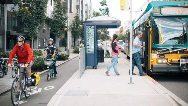
Biking barometers
Isaac Donis (‘17, see alumni profile below) oversees a Meetup group called Transit Techies, and recently, eager to resume in-person events once COVID-19 was no longer at its peak, he approached his alma mater seeking ideas.
The result of that conversation was a packed event that drew dozens of Meetup participants and featured Suzana Duran Bernardes, a Ph.D. candidate who studies Transportation Planning and Engineering and serves as a graduate research assistant at C2SMART, Tandon’s Tier 1 USDOT University Transportation Center. Bernardes earned her undergraduate degree in Brazil and later completed her master’s degree with C2SMART’s director, Kaan Ozbay (the author of multiple books on transportation systems and a frequent conference presenter and media commentator) as her advisor:; at the event, she presented BSafe-360, an all-in-one bicycle data collection tool she had created.
“The impetus for embarking on the project was the pressing need for accurate data on bike safety,” she explains. “There are many people studying autonomous vehicles, for example, but not enough research focused on the safety of non-motorized vehicles. We want to develop ways to measure safety that don’t rely on historical collision data; create a Machine Learning model for predicting collisions involving bicycles and for identifying key factors contributing to injuries and fatalities; and fuse information from other bicycle-related data sets such as NYCDOT cameras and Citi Bike trip data.”
A small multi-sensor device that easily mounts to the front of the bike, BSafe-360 gathers information about how close a car comes to a rider, its speed, and cyclist behavior. The device can also be connected to smartphones and smartwatches to collect data on the biker’s heart rate and anxiety level. It is now being tested in New York City and Brazil, and Bernardes hopes to forge partnerships with local city governments. “The tool can be customized for different purposes, depending on the data needs of an agency,” she says, “and we think it could greatly inform their efforts to improve bike safety.”
Also on hand to present at the Meetup was Ariel Kadouri, a software engineer at Woven Planet,, a Toyota subsidiary dedicated to safe mobility. Kadouri was not there, however, to discuss his day job — which involves building technology that keeps maps for autonomous vehicles up to date using sensors — but his community work on OpenStreetMap, a sort of Wikipedia aimed at providing accurate mapping information that is then used by Citi Bike, various hiking apps, and others.
He spends a few hours a week walking the city and noting information about roads, trails, train stations, and other important built features, and he encouraged other transportation enthusiasts to do the same. “It’s a way of providing a vital public service,” he says. “In addition to the actual mapping, we can call 311 if we see a problem like broken curbs or nonfunctioning street lights.”
While most of the tech tools required for the project are complex, meaning that it’s difficult for true laypeople to participate, he foresees their use becoming easier, as the technology evolves. “We want everyone pitching in to ensure that people plan the right trips via the right mode of transportation for them,” he says.
Donis, too, believes laypeople have much to contribute. “Transit Techies has its fair share of software developers, and we’re seeing slowly increasing numbers of infrastructure experts,” he says. “But we also welcome those who simply want to help improve their own commutes and make life better for their fellow New Yorkers by getting involved in transportation issues.”
Mapping it out
Last year Woven Planet partnered with NYU Tandon’s Visualization, Imaging and Data Analytics Research Center (VIDA) to compile a dataset of more than 200,000 outdoor images over the course of a year. The dataset is being used to test a range of visual place recognition (VPR) technologies that can improve the accuracy of personal and automotive navigation applications and promote independence for a variety of users.
Developed by a team from the Automation and Intelligence for Civil Engineering (AI4CE) lab led by Chen Feng, assistant professor of civil and urban engineering, mechanical and aerospace engineering, and computer science and engineering, as well as a member of the CUSP faculty, the dataset uses side-view images of sidewalks and storefronts in addition to forward-facing imagery, allowing researchers to test more applications than traditional mono-perspective sources. The project, sponsored by C2SMART, uses images originally provided by CARMERA Inc., an automotive mapping company and former participant in NYU Tandon’s Future Labs that was acquired by Woven Planet in 2021.
In the zone
In February, C2SMART held a workshop at New York State DOT Region 11, in Queens, to introduce their Data Driven Work Zone Impact & Conflict Estimation Platform (DWICE). Built by a team led by Kaan Ozbay and recent Ph.D. graduate Zilin Bian, DWICE is a web-based tool to help coordinate work zones by cataloging multiple types of work zone events, across multiple projects, on one easy-to-read map, allowing users to predict and mitigate impediments to traffic flow and reduce system strain. The tool enables DOT staffers to better plan roadway closures ahead of time, saving motorists valuable time. The platform — which merges city and state databases of required work and uses real-time data from several different sources through a machine-learning algorithm to make predictions and do the analysis —
was created through a Federal Highway Administration grant.
Alumni Profile: Isaac Donis
Unlike that of many alumni, Isaac Donis’s story does not involve a childhood dream of becoming an engineer or walking the hallowed halls of NYU.
“I was a good student with a natural talent for STEM that won me entry into Brooklyn Tech, one of the city’s most competitive high schools,” he recalls. “Despite that, what I really wanted to do was study classical music, but my family let me know in no uncertain terms that music would not be a viable career if I didn’t want to starve, so electrical engineering it was.”
And the choice of Tandon? “My mother was very intent that I remain in Brooklyn, close to home,” he admits.
Despite that seemingly inauspicious start, Donis excelled at the School of Engineering and found both a close community of friends and a career path. “Tandon now attracts large numbers of international students, but at the time I attended, there were really large numbers of commuters like me,” he recalls. “I was hired as a commuter assistant, which means I counseled first-year students who commuted from around the area rather than live in a dorm, helping them adjust to the school and access resources. There used to be a commuter lounge where the MakerSpace is now, and I spearheaded some much-needed improvements to it; I still feel proud of that accomplishment, and I trace my interest in transportation issues back to that time.”
In 2019 Donis — whose CV includes internships and summer posts at Con Edison, the NYC Department of Design and Construction, Goldman Sachs and Intel — became involved in the Meetup group Transit Techies, and after its organizers allowed activities to lapse even after the pandemic started to wane, in 2022 he launched a small competing group that attracted everyone from urban planners to average commuters. “The original group had been created by a digital marketing agency, which makes sense when you consider how many ads appear on trains and buses,” he says. “Eventually, after I started my own group, the original organizers admitted it made sense to have me take over and merge the two, keeping the name Transit Techies.”
At this point, he has been a lifelong commuter and now takes the PATH train to his post as a machine learning engineer at Prudential Financial. “ I actually enjoy it,” he says. “The ride is the most peaceful part of my day.”