NYU Tandon study maps pedestrian crosswalks across entire cities, helping improve road safety and increase walkability

Tandon researchers analyzed the length of thousands of crosswalks in three diverse cities providing a new tool for city planners to identify and address high-risk intersections.
As pedestrian fatalities in the United States reach a 40-year high, a novel approach to measuring crosswalk lengths across entire cities could provide urban planners with crucial data to improve safety interventions.
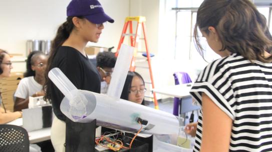
NYU Tandon School of Engineering researchers Marcel Moran and Debra F. Laefer published the first comprehensive, city-wide analysis of crosswalk distances in the Journal of the American Planning Association. Moran is an Urban Science Faculty Fellow at the Center for Urban Science + Progress (CUSP), and Laefer is a Professor of Civil and Urban Engineering and CUSP faculty member.
"In general, lots of important data related to cities’ pedestrian realm is analog (so it exists only in old diagrams and is not machine readable), is not comprehensive, or both," said lead author Moran, highlighting the gap this study fills. "We know that longer crosswalks pose increased safety risks to pedestrians, but rarely are cities sitting on up-to-date, comprehensive data about their own crosswalks. So even answering the question,‘what are the 100 longest crossings in our city?' is not easy. We want to change that.”
This study's unique contribution lies in its scale and methodology, potentially providing a powerful new tool for city planners to identify and address high-risk areas.
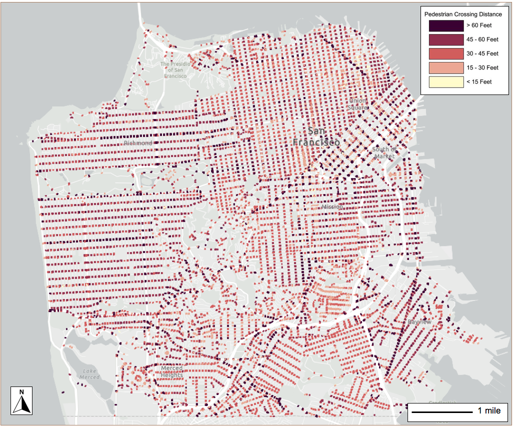
The team analyzed nearly 49,000 crossings in three diverse cities: a European city (Paris), a dense American city (San Francisco), and a less-dense, more car-centric American city (Irvine). To accomplish this, they employed a combination of data sources and techniques.
"We combined crosswalk distance measurements from two different datasets," Laefer said. "The first is from OpenStreetMap, which comes from a community of users who have crowdsourced and built a map of the world."
However, OpenStreetMap data alone wasn't comprehensive enough. "If we had only used OpenStreetMap, we would have been left with a lot of crosswalks missing," Laefer explained. "So we also used satellite imagery tools to measure the remaining crosswalk distances."
Their technique revealed distinct patterns in each urban environment. According to the published paper, the average crosswalk lengths were approximately 26 feet in Paris (.03% at 70 feet or longer), about 43 feet in San Francisco (4.4% at 70 feet or longer), and about 58 feet in Irvine (with about 20% at 70 feet or longer). Crossings over 50 to 60 feet start to show a higher concentration of pedestrian collisions, according to Moran.
The study confirmed a significant correlation between crosswalk length and pedestrian safety in all three cities examined. Longer crosswalks were associated with higher probabilities of pedestrian-vehicle collisions, with each additional foot increasing collision likelihood by 0.8% to 2.11%. Crossings where recent collisions occurred were 15% to 43% longer than city averages.
Moran sees this research as a powerful tool for city planners and policymakers. "The three cities we have mapped now have these datasets, and can evaluate different investments and make informed decisions in pedestrian infrastructure," he explained.
The potential for this research to inform public policy extends beyond these three cities. Moran and his team are planning to scale up their approach to the 100 largest cities in the United States, potentially creating a public resource for exploring crosswalk distances.
According to Moran, simple measures could significantly improve pedestrian safety on crosswalks. "Small low-tech ways to improve the pedestrian environment can really lead to safety benefits. These can include extending the sidewalks out from each side and putting pedestrian refuge islands in the middle," Moran noted.
This study is part of Moran's broader effort to improve urban transportation. He explains, "I'm trying to make urban transportation safer, more sustainable and more equitable. I use a variety of methods like mining data, satellite imagery and field collection to understand our streets, how they can change, and how those changes can lead to these improved outcomes."
Moran, M. E., & Laefer, D. F. (2024). Multiscale Analysis of Pedestrian Crossing Distance. Journal of the American Planning Association, 1–15. https://doi.org/10.1080/01944363.2024.2394610

Marcel Moran