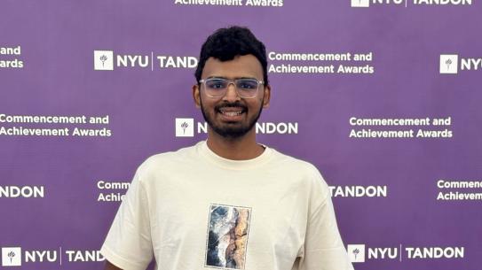
CUSP Experiential Scholar Ziwei Zhang applies urban science skills through an internship at Esri
Advocates for GIS research at NYU Tandon

Ziwei Zhang discusses his internship experience at Esri during an Experiential Scholar Showcase event hosted by CUSP
In 2024, the Center for Urban Science + Progress (CUSP) at NYU Tandon launched the CUSP Experiential Scholarship, which provides financial support to students who pursue for-credit summer internships or guided research in urban science-related fields. Ziwei Zhang, a second-year graduate student in the M.S. in Applied Urban Science and Informatics program at CUSP, is among the inaugural cohort and used the funding to support a summer internship at Esri, one of the world’s leading suppliers of Geographic Information Systems (GIS) software and related applications. Zhang has a strong background in GIS, having earned a B.S. in Geography and GIS from the University of Minnesota before pursuing graduate study at NYU.
"I had a rough idea of what I wanted to do even before coming to CUSP," Zhang explained. "I worked full-time for a year as a GIS technician at a research center in Minnesota. I knew what I was into and was already actively looking for internships before the Experiential Scholarship. Esri, being the leader in GIS, was an obvious first choice."
Zhang applied for a consultant position in Esri’s professional services department, which focuses on GIS consulting for both industry and government sectors. However, he received an unexpected offer to interview for a role in the company’s software development department instead.
“It caught me by surprise because I didn't have much of a background in developing software, but I was a really good user, which they valued," said Zhang.
As a product engineer, Zhang found himself working closely with developers, designing and shaping the direction of Esri's software tools. "We work closely with developers, but we're not actually writing the underlying code for our software tools. We're designing and shaping the direction of what the software should do. We also code a lot because we need to test our software,” said Zhang.
Standing out at Esri’s Weekend of Innovation 2024 with an app that solves a common problem
During his internship at Esri, Zhang took part in an internal competition, Esri’s Weekend of Innovation 2024, designed to foster innovation and creativity among the company’s interns. The brief was expansive, inviting participants to develop an innovative GIS solution for a pressing global issue. EasyAisle, developed by Zhang together with Chloe Smetanka, Rachit Gupta, Abhinav Gupta, and Alison Thomas, uses GIS technology to improve indoor navigation for delivery drivers in grocery stores. Specifically, it alleviates user pain points associated with finding items on shelves and managing multiple delivery platforms.
"It was a fusion of many ideas," Zhang explains. "I wanted to do indoor navigation, and our designer [Chloe Smetanka], who used to work at a grocery store, had insights into user pain points. Our developer [Rachit Gupta] was really into 3D navigation, like AR/VR. We bounced ideas off each other and narrowed it down to this middle ground where everyone’s ideas were integrated."
Zhang's role in the project involved building maps and underlying infrastructure for the application. Despite the challenge of navigating numerous technical documents in a compressed 24-hour timeframe, the team’s intensity and collaboration resulted in a successful project. EasyAisle provides a practical solution to a common problem — this combination of innovation and potential for impact led to its selection as the overall winner of the weekend challenge.
"It’s almost ready to commercialize. I think that helped us win in hindsight," Zhang reflected. "We started with the problem and then found a solution, rather than starting with the tech and looking for projects to fit it."
Reflecting on real-world experience to chart the future
The internship at Esri, along with Zhang’s current position as a Graduate Assistant at NYU Data Services, has shaped his career plans. At Data Services, Zhang leads introductory GIS workshops for students and faculty, helping to raise awareness and encourage the use of GIS across various disciplines. In this role, Zhang values the opportunity to connect with library patrons and make a positive impact. “I talk to patrons about their problems and use of GIS, and guide them through their difficulties. It feels like I'm opening doors for people,” said Zhang.
When asked about his dream project, Zhang shares his ambition to map all of the subway stations in New York City using indoor technologies like LiDAR, BIM, and ArcGIS Indoors. "We have a faculty member at CUSP, Professor Deborah Lafer, who is mapping underground infrastructures like pipes, wires, and broadband. I think this research can benefit from indoor technology," he said. "It would be great to have an indoor map of New York City subways. It's ambitious, but it would be crucial for construction and accessibility issues."


