
FloodNet NYC Reaches 400 Sensors, Providing Citywide View of Street-Level Flooding
Network has recorded more than 2,400 flood events since 2020, capturing how storms move across all five boroughs in real time
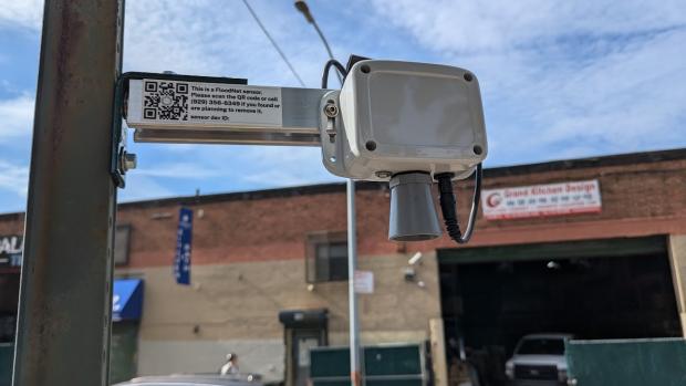
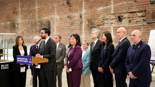
FloodNet NYC, a street-level flood sensor network developed by NYU Tandon School of Engineering in partnership with the CUNY Advanced Science Research Center (ASRC) and Brooklyn College, has deployed its 400th sensor in New York City.
The milestone marks a significant expansion of the network's capacity to monitor hyperlocal flooding conditions caused by heavy rainfall, overburdened drainage infrastructure, storm surge, and rising sea levels, data that government agencies are using in real time to respond to storms and plan for future incidents.
Since the first sensor was installed in October 2020, FloodNet has recorded more than 2,400 flood events at locations across all five boroughs. Unlike most urban flood monitoring systems, which track waterways and tidal gauges, FloodNet sensors measure water depth directly on streets, sidewalks, and in low-lying areas across the city, places that impact daily life.
The network's citywide scale has become increasingly evident during major storm events. While FloodNet's real-time map shows current flooding conditions in the city, the project also provides interactive views of select past storms.
During a July 18, 2026 storm, for example, sensors revealed the progression of major flooding on Queens streets.
During a May 20, 2026 storm, sensors recorded severe flooding concentrated in Central Brooklyn and South Queens, including nearly four feet of water in Hollis, Queens, conditions that went largely unnoticed in other parts of the city.
FloodNet's complete dataset, covering all sensor deployments and flood events across the network's history, is publicly available on the NYC Open Data portal. The data fills a pronounced gap. Before FloodNet, city agencies had no quantitative, real-time picture of where street-level flooding was occurring during a storm, relying instead on 911 calls and social media reports.
"In many ways city agencies were previously unable to see a distributed picture of conditions during a flood event," said Andrea Silverman, NYU Tandon Institute Associate Professor and one of FloodNet's principal investigators. "With 400 sensors across all five boroughs, we can now see the impacts of storms as they move through the city in real time. That's something that simply wasn't possible before.”
“We're capturing flooding in neighborhoods that have never before had quantitative flood data, and that record is only going to become more valuable as the city plans for a future with more frequent and intense storms,” added Charlie Mydlarz, FloodNet’s Technical Lead and a research associate professor in NYU Tandon’s Center for Urban Science + Progress.
One immediate benefit is for emergency response. NYC Emergency Management (NYCEM) receives FloodNet data in real time, using it for situational awareness and to direct recovery efforts in the hours after a storm. The National Weather Service's New York office uses the data in flood warning decisions and storm impact cataloging.
“As heavy rainfall becomes more frequent and intense, having real-time information about where flooding is occurring is critical to protecting New Yorkers,” said NYCEM Commissioner Christina Farrell. “FloodNet gives our emergency managers a clearer picture of street-level conditions across the five boroughs, helping us make faster, more informed decisions during storms. The expansion of this dataset will strengthen our ability to respond to severe weather, direct resources where they're needed most, and better prepare New Yorkers for future flooding events.”
Beyond real-time response, researchers and city planners are using the historical dataset to calibrate and validate predictive flood models. The city is required to update its stormwater flood maps at least every four years, and that process depends on precisely the kind of data FloodNet provides. Those maps carry significant downstream implications for real estate, infrastructure investment and other areas that are increasingly important as NYC embarks on an ambitious affordable housing plan with new construction and conversion occurring across the city.
FloodNet has been supported by more than $6 million in city funding that commissioned the installation of the sensor network, with sensor placement guided in part by community organizations with firsthand knowledge of where flooding most impacts their neighborhoods.
The project's open-source sensor design has since been adopted by researchers in New Jersey, Rhode Island, Puerto Rico, and Brazil, demonstrating how a technology developed for NYC has become a model for street-level flood monitoring worldwide.